

Normanby Top [The Wolds]
Good walks are even better shared.
TF1296 : Trig Point TF121964
Dave Wright Photo source
Overview
Normanby Top [The Wolds]
Normanby Top, a delightful Marilyn sitting at an elevation of 86 meters, beckons hikers with its rolling chalk hills and breathtaking views. Located in the stunning Lincolnshire Wolds, this spot offers a peaceful retreat from the hustle and bustle, where the only company you'll have may be a friendly sheep or two.
Geology
The Lincolnshire Wolds were shaped during the Cretaceous period, with soft chalk deposits forming these gentle hills. This unique geological background creates not only picturesque landscapes but also a rich diversity of wildlife and flora. Remember, no climbing Everest here, just a gentle stroll!
Route
The favourite route, known as the Normanby Hill Path, is ideal for anyone looking to stretch their legs without breaking a sweat. Covering approximately 3.2 km and taking about an hour and a half to complete, this path provides a lovely, easy ascent with panoramic views awaiting you.
Summit Features
At the top, you’ll be greeted by a friendly trig point, perfect for a quick photo opportunity. Don't forget to capture your joyous achievement against the backdrop of the beautiful Wolds – after all, it didn't happen if you didn't post it on social media!
Terrain
The terrain is primarily grassy, with a few rocky outcrops scattered throughout, making the walk enjoyable and not too strenuous. Just watch your step in wet weather as it can get a tad slippery!
Views
From the summit, you'll be able to survey the expansive English countryside, catching sight of charming villages dotting the landscape, which bring a sense of tranquility. To enjoy the views at their best, aim for visits in spring or autumn when the colours come alive.
Hazards
Although the ascent is easy, be wary of local wildlife, particularly farm animals, as they may have staked a claim on the area. Stick to marked paths to ensure safety and sustainability of the beautiful surroundings.
Access
The nearest parking area can be found at TF 119 962, just a short jaunt from the path leading up to Normanby Top. If you're relying on public transport, don't fret; there are buses regularly running from Louth, so you can get your hiking fix without needing a car. Louth itself is only about 6 miles to the southwest and offers various facilities for refreshments.
Facilities
In Louth, you’ll find an array of lovely pubs and cafes, ready to reward you for your endeavours with a hearty meal or a refreshing pint after your trek.
History
The name 'Normanby' holds historical context, signifying 'farm by the river', hinting at the area's agricultural past. The Lincolnshire Wolds are also designated as an Area of Outstanding Natural Beauty, showcasing their ecological and cultural significance.
In conclusion, whether you're a local or a visitor, Normanby Top is a charming destination – perfect for a leisurely hike, a picnic, or just to bask in the beauty of the English countryside. So grab your walking shoes and a packed lunch, and enjoy all that this delightful Marilyn has to offer!
Explore routes near Normanby Top [The Wolds]
Walks starting near this hill. Open a route to check its map, distance and full itinerary.
beach day’
View route
Lincoln City Walk with Castle
View route
Southrey to Kirkstead Bridge: Water Rail Way riverside return
View route
Spurn birdwatching walk
View route
Route planning notes
These notes describe possible approaches. Check a route's map and access information when planning your walk.
Normanby Hill Path
A gentle ascent offering picturesque views of the surrounding countryside.
Make a day of it, together
Find someone to share the walk with, or organise a day out along a route you like.
Photo Gallery
View all Photo could not load
TF1296 : Trig Point TF121964
Dave Wright
 Photo could not load
TF1296 : Trig point at Normanby Top
Roger Cornfoot
Hill facts and local notes
Classifications
Elevation
168m
551 ft
Prominence
162m
Coordinates
53.4531, -0.3132
TF121964
OS Map
113
Explorer: 282 284
At the Summit
The summit features a small trig point, an iconic marker of elevation, perfect for a selfie with a view.
Terrain & Geology
The Wolds are primarily composed of chalk, formed during the Cretaceous period, giving rise to soft, rolling hills that are rich in diverse flora and fauna.
Views & Scenery
From the summit, you can spot the rolling hills of the Lincolnshire Wolds, as well as quaint villages scattered across the landscape.
History & Heritage
Name Origin
The name 'Normanby' derives from Old Norse roots, meaning 'farm/settlement by a river'
Historical Significance
The Lincolnshire Wolds hold historical significance, being an Area of Outstanding Natural Beauty and an important habitat for various species.
Getting There & Facilities
Parking
A small parking area is available at TF 119 962, only a short walk from the path leading to Normanby Top.
Public Transport
Buses run regularly from nearby towns such as Louth, with services operated by Stagecoach.
Nearby Facilities
There are a few pubs and cafes in Louth for refreshments and toilet facilities.
Safety Information
Known Hazards
- Beware of farm animals and keep to marked paths. Although the elevation is modest, wet weather can make paths slippery.
General Safety Tips
- Check weather conditions before setting out
- Carry appropriate clothing and equipment
- Let someone know your planned route
- Take a map, compass, and GPS device
- Carry emergency supplies: food, water, first aid kit, torch
Hills
Some common questions about the hills answered
Are there group walks up Normanby Top [The Wolds]?
Many walkers use Walkmates to join or organise walks with others. You can check for group walks around Normanby Top [The Wolds] through the maps
Are there other walkers around Normanby Top [The Wolds]?
Activity varies by location and time, but Walkmates lets you see whether others have shared walks or shown interest in this area. Find other people through the walking friends search walking friends for Normanby Top [The Wolds] search or of course create your own walk for Normanby Top [The Wolds]
Can I organise a walk to Normanby Top [The Wolds]?
Yes. If there aren’t any walks listed already, you can create a walk and make it available for others to join.
If you're signed up to Walkmates, you can create a walk to Normanby Top [The Wolds].
How do I find a walk up this hill?
There are often multiple ways to walk this hill, depending on experience and route preference. Walkmates helps you explore walks and routes that others have shared.
Can I suggest a new route up Normanby Top [The Wolds]?
Yes. You can suggest or create routes to share with others. Walkmates focuses on the social side of walking, so routes are used to help people organise walks and explore areas together, rather than as detailed navigation tools or route libraries.
Other uses really appreciate knowledgeable walkers sharing their routes. Share your favourite route to Normanby Top [The Wolds] here
The is an error or something incorrect about this hill. How do I let you know?
We always strive to keep the information on Walkmates as accurate as possible. If you find an error, please let us know through the contact form and we'll aim to correct it as quickly as possible
Community Discussion
Comments
Location
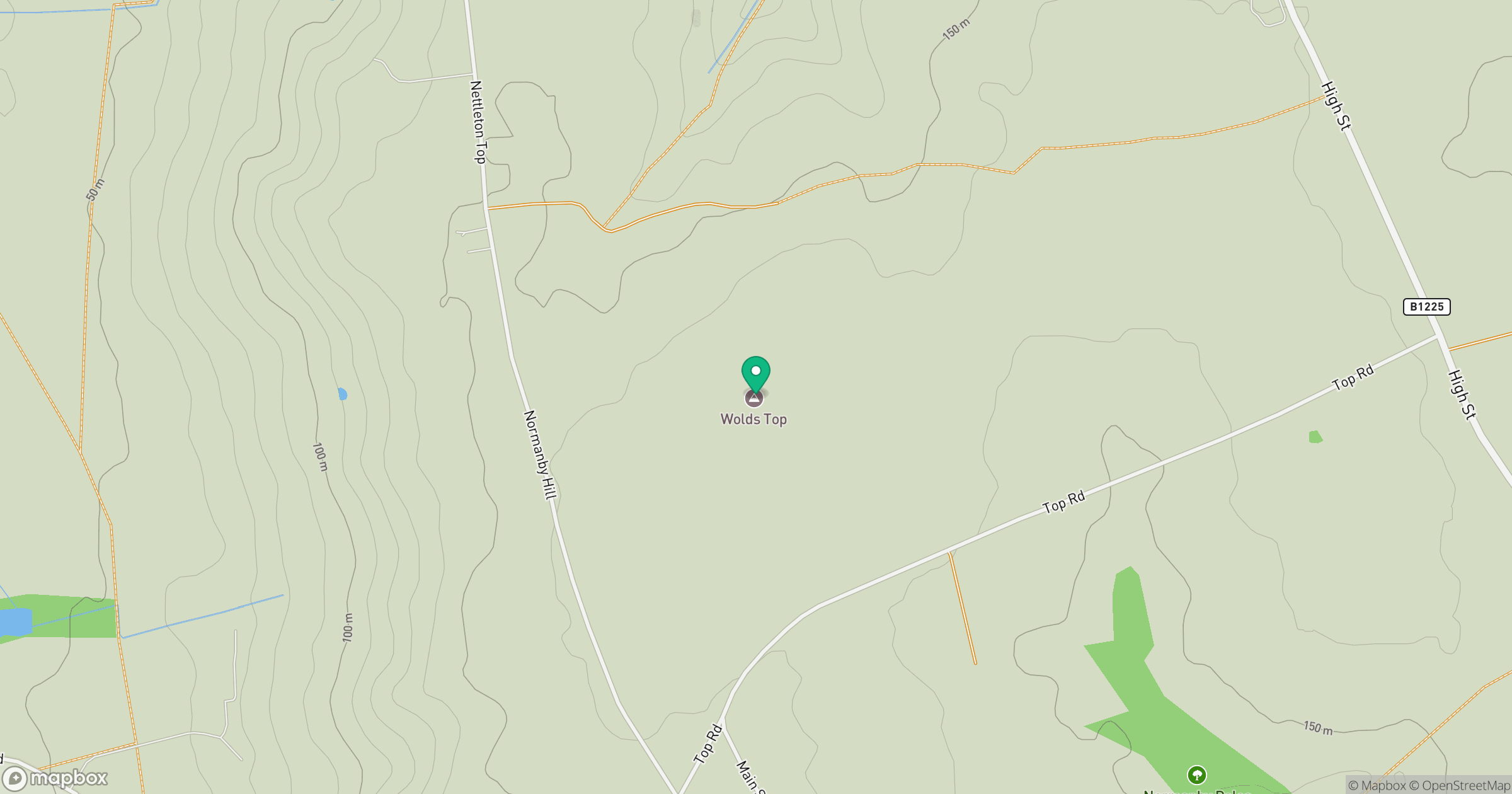
Grid reference: TF121964
View on OpenStreetMapOpens a map in a new tab, centred on the hill.
Nearby Hills
Kinder Scout
636m
Rombalds Moor [Ilkley Moor]
402m
The Roaches
505m
Buckden Pike
702m
Pendle Hill
557m
No comments yet. Be the first.